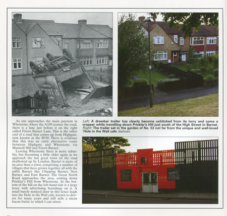
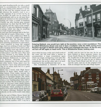
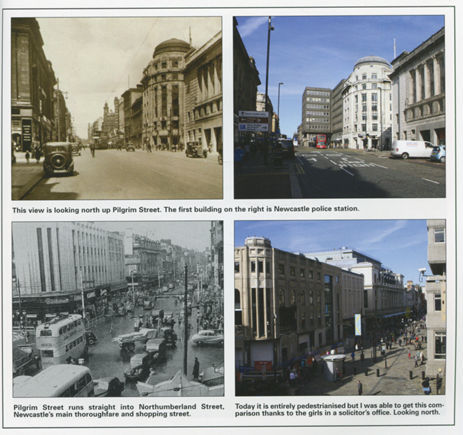
Since 1922 officially classified as the A1, roads have changed so much since the original that in places we are left with an intriguing trail of discovery as we travel the 400 miles and follow every twist and turn of the old road including tiny country lanes and the remains of bygone carriageways, dead ends and wayside resthouses of distant memory. The Great North Road was the original incarnation of the A1 and A1 (M), the first major road which ran through towns and villages and carried Roman legions from north to south and back, from London to Edinburgh. In the days of turnpikes and the coaching era the York stagecoach took four days and the service began on Friday 12th April 1706. The book charts the rise and fall of roads and the Ministry of Transport, the Old North Road which began at Bishopsgate and the Great North Road which started at the General Post Office building at the southern end of Aldersgate Street in the City. The first toll gate stood at Islington, shown here in a print of 1809 and alongside is the 'now' colour photograph of the busy high street. In 1813, Archway was constructed to avoid the steep hill at Highgate, demolished in 1900 to be replaced by the present bridge, but in doing so London lost the landmark proclaiming where town and country met. North Finchley, the Battle of Barnet, the M25 to Baldock, here are old bypasses rebuilt, how this Great North Road passed through places such as Potters Bar High Street, alongside pubs and tea shops. We see how Hatfield has changed dramatically along with dozens of towns and villages on the route shown in superb archive photographs alongside a 2013 colour photograph together with many maps and other historic images. 216pp in elegant heavyweight large softback.
Additional product information